
2019 Nav-X Challenge @ Harvey Bear
UPDATE: COURSE SETTER NOTES - CLICK HERE
Quick Info
Date: Sunday, Oct 6th, 2019
Location: Harvey Bear Ranch County Park, Gilroy, California
Event Director: Dennis Wilkinson (contact)
Course Directors: Lubomir Sebo
Courses: 3 & 6h Map Trek
List of Registered Entrants
Follow this link to an updated list of entrants.
Event Summary
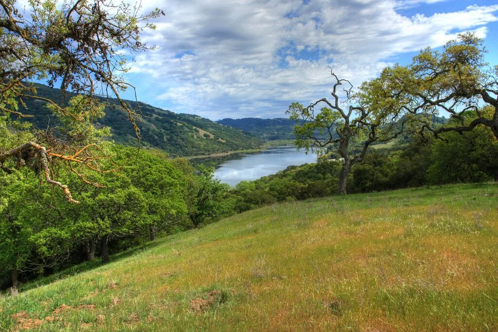
The 5th event in the 2019 Nav-X Challenge series brings us to a Wilderness just 40 minutes from downtown San Jose. Harvey Bear Ranch County Park is a vast wild area with oak studded hills, right next to Henry Coe State Park near Morgan Hill, CA. Using a map produced by the Bay Area Orienteering Club, course setter Lubomir Sebo will be treating us to a Map Trekking adventure sure to please any navigation sports enthusiast, whether you are looking for a scenic 3 hr hike in the green hills, or a 6 hr endurance race against some of the best in the West.
Schedule
| Time | Long Course - 6h | Short Course - 3h |
|---|---|---|
| 8:00 | Event Check-in (and Day of Event Registration) | |
| 9:00 | Event Check-in (and Day of Event Registration) | |
| 9:15 | Event Briefing | |
| 9:30 | Mass Start | |
| 10:15 | Event Briefing | |
| 10:30 | Mass Start | |
| 13:30 | Finish | |
| 14:15 | 3h Awards | |
| 15:30 | Finish | |
| 16:15 | 6h Awards |
New to Map Trekking or Rogaining?
Map Trekking is a “Navigation Sport” that has elements of a few other sports and activities like Trail Running, Fell Running (XC hill running), Hiking, Orienteering and Geo Caching. More specifically, Map Trekking is a time-based challenge, 2 hrs or more in length, where participants try to score as many points as possible within the time allowed, by visiting checkpoints scattered across a vast, wild landscape. Participants are free to decide which checkpoints to visit, and in what order. Typically, a set time is allowed before the start for participants to study the map, and determine their route. Participants travel on foot and navigate their chosen route using the map and a compass (No GPS allowed except for recording your track). A late finish comes with point penalties, adding another layer of challenge to the sport. Checkpoints vary in difficulty and the point value reflects the same, so that easy ones yield a lower point value than difficult ones. To encourage beginners, course setters typically provide plenty of easy checkpoints near the start and finish location.
Venue / Park Info
The park is a 6,695 acre regional recreation area, nestled in the hills east of Gilroy, CA, and features a 449 acre lake for fishing and boating. The park provides habitats for many species of birds, reptiles, amphibians, insects and mammals. The park is home to rare western pond turtle, California tiger salamander and Bay checkerspot butterfly. Two-Hundred-Nineteen species of birds have been seen, including our “National Bird” the bald eagle. During your visit you can also be sure to see black-tailed deer, and turkeys. Visitors can explore over 33 miles of trails that wind through cool oak forests and along breezy ridgelines with wonderful views.
About the Map
The Harvey Bear Ranch & Coyote Lake map was made by Matej Šebo for 2012 Golden Goat. The map has been revised and expanded for other BAOC events.
The map will be printed at a 1:12,500 scale on 22”x17" paper. The contour interval is 5 meters.
Most of the park is open land (mapped orange) with some forest (mapped white). Vegetation boundaries are reliable and detailed. Large lone trees are mapped with the hollow, green circle symbol; small lone trees and bushes are shown as green dots. Brown ×'s are fallen trees, green ×'s are dead trees that are still standing.
Courses & Divisions
There will be two courses offered:
3 hr Map Trek
6 hr Map Trek
Participants can compete in the following divisions:
Junior (19 & Under, 1-5 person teams)
Open Female (20-49, 1-5 person teams, All-female)
Open Male (20-49, 1-5 person teams, All-male)
Open Mixed (20-49, 2-5 person teams, mixed Male-Female)
Masters Female (50 and up, 1-5 person teams, All-female)
Masters Male (50 and up, 1-5 person teams, All-male)
Masters Mixed (50 and up, 2-5 person teams, mixed Male-Female)
Family - Adults (20+) + children (12 & under)
Results from this event count toward the 2019 Series Championship.
Price
Early fees (20% off) through Sept 22nd (via online registration). Regular fee is Sept 23rd - Oct 3rd (via online registration). Day of Event Registration is cash or check only.
Discounts for orienteering club members (BAOC/GCO/etc...), $3 for adults (no member discount for juniors). Discount applied during online registration process.
For family teams (2-hr course only), it is required to have at least one adult (20 & over) and at least one child (12 & under). Children 12 & under race free. Children must be registered and accompanied by an adult.
Additional fees to rent an e-punch ($5) and/or compass ($2). Only one e-punch number or rental request is required per team. On the registration page, please enter "0" for e-punch number if you are not the first person registering for your team. No e-punch trade-ins allowed (ie. to get a higher punch count e-punch).
| Early Registration | Regular Registration | Day of Event Registration | ||||
|---|---|---|---|---|---|---|
| Course Length | 3h | 6h | 3h | 6h | 3h | 6h |
| Junior (19 & Under) | $16 | $26 | $18 | $29 | $20 | $33 |
| Adult (20+) | $32 | $52 | $36 | $59 | $40 | $65 |
Refund Policy
Refund policy: 100% refund up to 10 days before event. Future race credit 1-9 days before event. No refunds for no-show.
What to Bring
Wear what you would normally wear for a strenuous hike in Northern California. Here are some tips:
Sturdy shoes with a good tread
Long pants or gaiters
Visor hat
Compass (you may rent one for $2)
ePunch (SI stick with 50 control capacity - you may rent one for $5 if you don’t have one)
Pen and maybe a highlighter marker (for marking up your map and making notes)
Water (enough for the time you will be out on the course)
On the go snacks (energy bar, gel, etc.)
Map and Directions
Not at the Coyote Lake entrance!
From U.S. Highway 101 in San Martin, take the San Martin Ave exit. Proceed east on San Martin Ave for 2 miles. The entrance to the park is on the left, 0.25 mile east of Foothill Avenue.
Carpool if possible, parking is limited