
2026 Nav-X GPS MAP TREK #6 @ Monte rio redwoods
Quick Info
Date: Thursday, October 1 to Monday, November 30
Location: Monte Rio Redwoods Regional Park, Monte Rio, CA
Courses: 3hr & 6hr GPS Map Trek
Prices: $20 (3hr) & $27 (6hr); Juniors 50% off, Club members $4 off, Children 12 & under FREE; also see below for pre-printed map options.
Map Handout: Sunday, November 1 at 9:30-10:30am
Notes about registration: An Orienteering USA membership is not required: instead, use the Enter Data Manually option instead.
If you are part of a team, everyone on your team (over 12 years of age) must register separately.
LINKS to MAPRUN EVENTS (click link while using smartphone)
INTRODUCTION
We have set up a course with 46 checkpoints on a new map in the Monte Rio Redwoods near Monte Rio, CA. Get as many checkpoints as you can in either 3 or 6 hours using the Smartphone app named “MapRun” to record your visit to each checkpoint based on your GPS position.
The competitive window for this event is October 1 - November 30, 2026. Results during this time period will be included in the official results and accrue Nav-X series points but the course will still be available on MapRun until Dec 15, 2026, after which it will move to the archived courses. Upon registration, you will receive (1) registration confirmation, (2) within 24 hours, a separate email with links to map documents.
Pre-printed maps are available by mail for $10. Maps will generally be mailed to arrive in your mailbox within 7 days of registering. Available until November 1.
Our suggested race time is Sunday, November 1 at 10am. We will have a Nav-X team member there to hand out pre-printed maps if you register for this option ($6) by October 26. Since this is not an official event, there will be no signage so just meet the Nav-X staff member at the start triangle. The maps will be available from 9:30 - 10:30am.
IMPORTANT SAFETY NOTES
YOU ARE DOING THIS AT YOUR OWN RISK - WE TAKE NO RESPONSIBILITY FOR ANY INJURIES OR DEATH. HAZARDS INCLUDE STEEP HILLS, LOOSE ROCKS, CLIFFS, OCCASIONAL DENSE AND SHARP BRUSH, POISON OAK AND TICKS.
CELL COVERAGE - There is cell phone coverage at the higher elevations of the park but cell signal in the parking lot is extremely weak.
WHISTLE - Due to the self-serve format, you may be completely on your own when you run your course. Be aware of this! You should bring a whistle in case of an emergency.
WATER - There is no water available at the start/finish or anywhere else on the course! It is strongly recommended to bring all the water you need on the course with you.
POISON OAK - on the lower end of Bay Area parks.
TICKS - are present in the area.
EVENT INFORMATION
MAPRUN - Please see this page for instructions on how to use the MapRun smartphone app. It’s important that you load the course while you still have Internet service. Search for “2026 Nav -X GPS Map Trek Monte Rio Redwoods” and pick the right course (3-hr or 6-hr). Or you can click one of the links provided above to load the course.
DIRECTIONS TO START: The start is located on a trail junction just southeast of the Monte Rio Redwoods RP parking lot and is just far enough from the parking area so that you don’t accidentally trigger it when you park (note that Google Maps places the trailhead a little farther south than the true location because the parking lot is new). To get there, Follow highway 101 north or south to exit 488B near downtown Santa Rosa. Follow highway 12 west for 3.4 miles, turn right on Fulton Rd and then immediately left on Occidental Rd. Follow for 7.2 miles and turn right on Green Hill Rd. After 0.8 miles, turn left on Graton Road and follow 2.8 miles to the town of Occidental. Turn right onto the Bohemian Highway and follow 4.8 miles and then continue straight onto Main St. The trailhead parking lot is a further 0.8 miles on your left. The turnoff for the parking lot is not well marked so follow these GPS coordinates to get to the right spot.
PARKING - Day use parking ($8) can be purchased using envelopes provided next to the iron ranger at the end of the parking lot. You will need to have exact change and then place the payment stub on your dashboard. The parking lot is generally open from 8am-6:00pm and then 8am-4:30pm after Daylight Savings time ends in November. Alternatively, you can park along Main Street for free and walk to the start along the trail that starts on the highway just southeast of the parking lot and not have to worry if the gate to the parking lot will be locked.
BATHROOMS - There is a portable toilet located just off the parking lot near the start but no water. There are also modern bathrooms, parking, and food options at Creekside Park which is 0.3 miles north of the trailhead on Main St.
GEAR RECOMMENDATION - We recommend participants bring the following:
Smartphone - goes without saying since we are using an app for timing
Compass
Long pants or at least gaiters for the tall grass, brush, and poison oak
Snacks & Water, especially if you are on the long course
Whistle for safety
TRASH - While on the course, practice Leave No Trace (LNT) - bring all trash back to the parking area.
BE DISCREET - We don’t have a permit so try not to be too noticeable when entering or exiting off-trail areas.
MAP & COURSE NOTES
VENUE - Monte Rio Redwoods Regional Park is a brand-new area for navigation sports. The regional park has 2000+ acres after a recent expansion and connects with the Willow Creek addition to Sonoma Coast State Park, a section of which is also included on the map.
PROHIBITED AREAS: The map will show the out of bounds areas as purple cross hatching or olive-green colors. In addition, there are some trails that are designated as mountain bike only. You will be able to cross those trails, but it is illegal to run along them. Luckily, the mountain bike trails run parallel to roads that you can use and are faster than the mountain bike trails anyways. The off-limit trails will be marked on the map with a purple trail symbol with purple X’s on top of it.
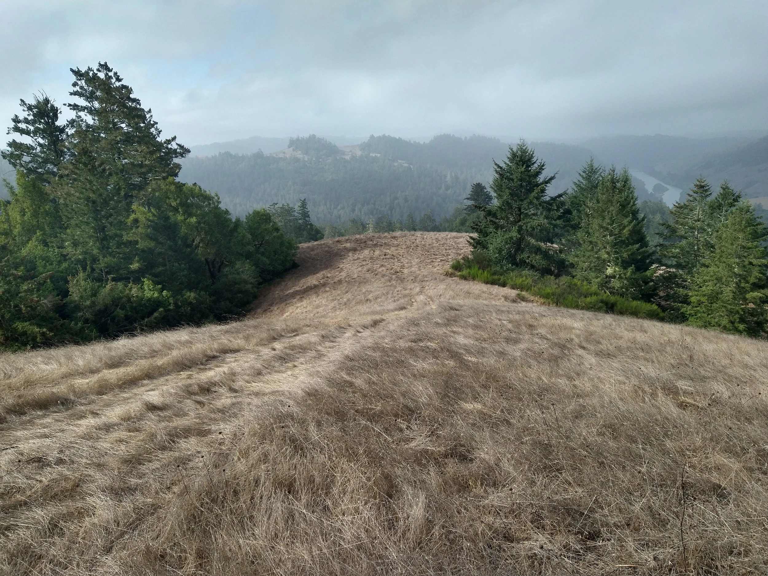
TERRAIN - Mostly forested with some open grassland at the south end of the map. As the name of the park suggests, the forest contains an abundance of stunning redwood trees. Monte Rio Redwoods Park is mostly forested while the Willow Creek area (south and west parts of map) has some open land on top of the ridges. As with many redwood forests, the terrain can get very steep and combined with loose footing, travel times will be very slow in the forest. The best strategy is to follow line features such as roads, trails, and old logging roads to get as close as possible to the checkpoints before venturing off trail. Particularly, you should traverse the steep areas on a line feature and try to go through the forest only when it’s not as steep. In those not-as steep areas, the forest is actually quite nice.
MAP - The map was created in Aug and Sept 2026. It has 5 meter contours, vegetation density (3 shades of green), some cliffs, and water features based on high quality LIDAR data collected in 2013. Roads, trails, fences, and other features were added using Google aerial imagery and Strava Global heatmap. Other features were added and adjusted during field checking but the map lacks most orienteering-level detail such as boulders, knolls, rootstocks, single trees, etc. The Lidar vegetation mapping is very accurate. The narrow ride symbol is used to denote an old logging road (road grade). These are often overgrown with no trail but are still useful for navigation and speed. All the logging roads near checkpoints have checked for accuracy but there are many others that were just drawn from the Lidar data. Some of these old logging roads are so good they were shown as vehicle tracks. Others are overgrown and are shown with a narrow ride symbol that has 2 different shades of green to indicate the level of overgrowth.
COURSE - The course was designed by Heidi Cusworth and set in the field by Bill Cusworth. There are 46 checkpoints varying in point value from 20 to 100 points. The approximate straight-line distance to get them all is about 17 km. Generally, higher value checkpoints are farther from the start, harder to find, or some combination of both. Due to the ruggedness of the terrain, many of the checkpoints are located close to line features such as roads, trails, and old logging roads. You can do most of the checkpoints as out and back from a line feature or save distance by going straight through the steep sometimes thick woods.
START - The start area is shown on your map as a triangle and is on a trail just southeast of the parking lot. Do not approach the start until you are ready to go! Your GPS device will start you automatically and alert you by beeping once you are within ~15 meters of the spot. The start is on the northeastern edge of the map.
SCORING: Just like our other events, each checkpoint has a point value reflecting the difficulty (higher point value for tougher checkpoints). The point value is the “10 part” of the checkpoint code. Examples: 33 = 30 points, 50 = 50 points, 88 = 80 points, etc. Late penalty is 10 points per minute or any part of a minute (1:01 late = -20 pts)
MARKERS - All checkpoints have been streamered with orange flagging tape with “Nav-X” written on them. Streamers sometimes get removed by humans or get chewed by animals - so if MapRun beeps at a checkpoint but you see no streamer, don't worry - just carry on. Conversely, if you get to a streamer and MapRun does not beep, continue your course and you can get it fixed by following the steps in the instruction document. The start/finish and checkpoint #20 do not have flagging because they are in public places. Also, checkpoint #34 has pink flagging.
FINISH - the finish is marked on your map with a double circle and is located at the same place as the start. When you are within ~15 meters of the spot, your GPS device will register a finish. Do not approach the finish until you are ready to end your course. (Depending on the device, it may be possible to continue the course after this, for example if you approached the finish spot by accident. However, this might not work for you, so we recommend you don’t go near the finish until you are done.) Remember to upload your result after you finish (if it doesn’t happen automatically).
MAP PRINTING - We are providing a Zip file with the map documents in PDF format within 24 hrs of registration. The text checkpoint descriptions are on the map. You will need to print your own maps or choose one of the 2 pre-printed map options. For $10, you can have a map (1:10,000, 13”x19”) mailed to your address (allow 7 days for maps to arrive); this option is available until November 1. For $6, you can pick up a map at the in-person meetup on Sunday, November 1 from 9:30 am- 10:30am; this option is available until October 26.
If you want to report any problems with the course, please email info@navxchallenge.com.
Thanks for reading and have fun! - Bill and the Nav-X team