
2023 Nav-X Challenge @ Pacheco
Quick Info
Date: Sunday 30 April
Location: Pacheco State Park, between Gilroy and Santa Nella on 152
Courses: 3h & 6h GPS Map Trek
Registered entrants: Follow this link!
Introduction
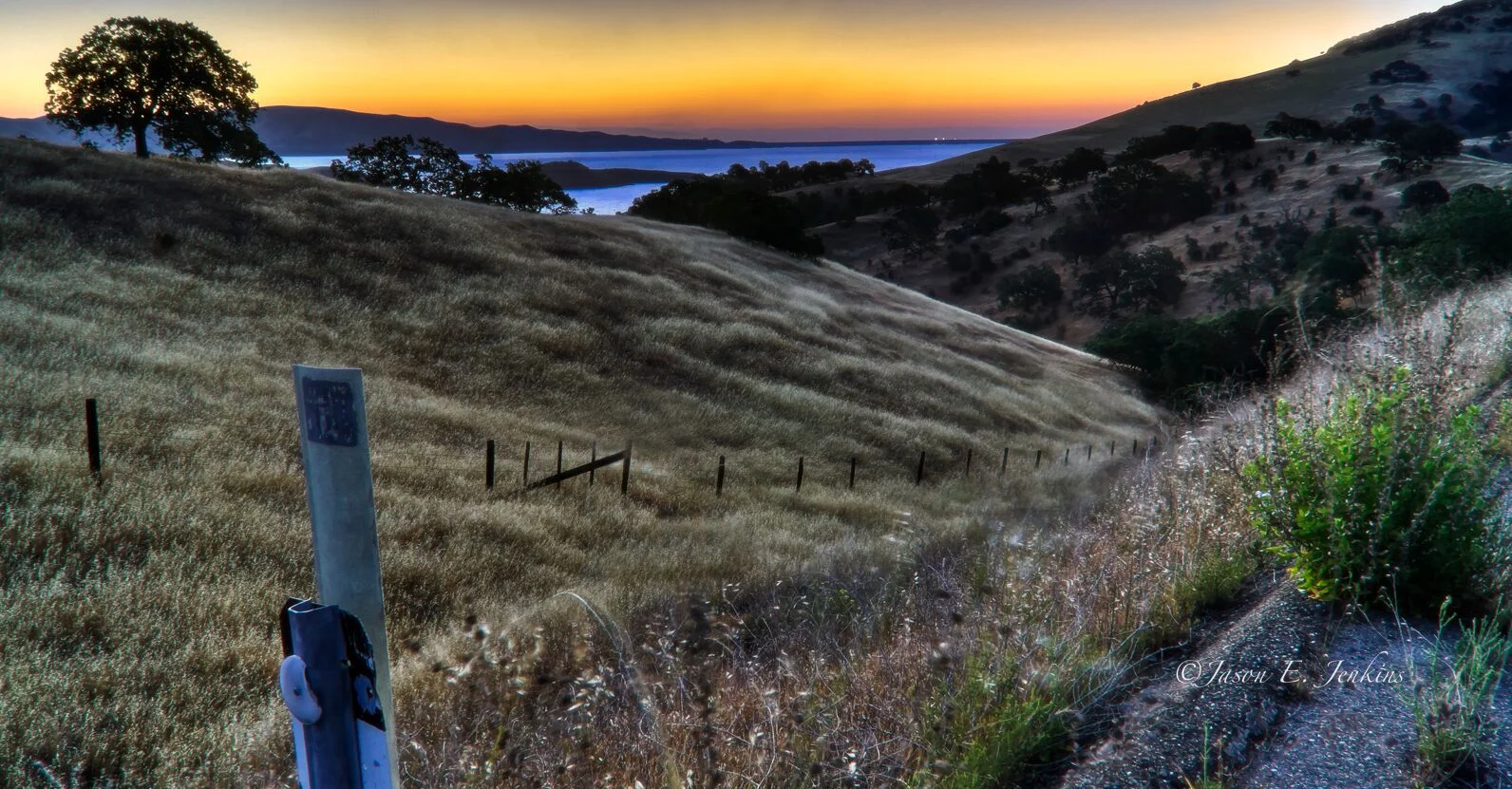
We are hoping you can come down to Pacheco State Park in the rolling hills of the San Joaquin Valley to enjoy our first in-person trekking adventure of 2023. The oak-studded hills are green and flowers are blooming!
REGISTRATION
Discounts for orienteering club members (BAOC/GCO/etc...), is $3 for adults (no member discount for juniors). Discount applied during the online registration process.
For family teams, it is required to have at least one adult (20 & over) and at least one child (12 & under). Children 12 & under race free. Children must be registered and accompanied by an adult.
Additional fees to rent an e-punch ($5) and/or compass ($2). Only one e-punch number or rental request is required per team. On the registration page, please enter "0" for e-punch number if you are not the first person registering for your team. No e-punch trade-ins allowed (ie. to get a higher punch count e-punch).
Day of Event Registration is cash or check only.
Refund policy: 100% refund up to 10 days before the event. Future race credit 1-9 days before the event. No refunds for no-show.
Schedule
| Time | Long Course - 6h | Short Course - 3h |
|---|---|---|
| 8:00 | Event Check-in (and Day of Event Registration) | |
| 9:00 | Event Check-in (and Day of Event Registration) | |
| 9:05 | Event Briefing | |
| 09:30 | Mass Start | First timer Clinic |
| 10:05 | Event Briefing | |
| 10:30 | Mass Start | |
| 13:30 | Finish | |
| 14:00 | 3h Awards | |
| 15:30 | Finish | |
| 16:00 | 6h Awards |
PRICE
| Early Registration | Regular Registration | Day of Event Registration | ||||
|---|---|---|---|---|---|---|
| Course Length | 3h | 6h | 3h | 6h | 3h | 6h |
| Junior (19 & Under) | $16 | $26 | $18 | $29 | $20 | $33 |
| Adult (20+) | $32 | $52 | $36 | $59 | $40 | $65 |
COURSES AND DIVISIONS
There will be two courses offered: 3h Map Trek (Sport) and 6h Map Trek (Endurance)
Participants can compete in the following divisions:
Junior (19 & Under, 1-5 person teams)
Open Female (20-49, 1-5 person teams, All-female)
Open Male (20-49, 1-5 person teams, All-male)
Open Mixed (20-49, 2-5 person teams, mixed Male-Female)
Masters Female (50 and up, 1-5 person teams, All-female)
Masters Male (50 and up, 1-5 person teams, All-male)
Masters Mixed (50 and up, 2-5 person teams, mixed Male-Female)
Family - Adults (20+) + children (12 & under)
Results from this event count toward the 2023 Series Championship.
MAP AND COURSE NOTES
Map: The print scale will be 1:15000 with a contour interval of 5 meters and will be printed on an 11 x 17 sheet of regular paper with a map bag. The map was updated significantly for this event. The map symbols were updated to the latest ISOM 2017-2 standard. Also, the map was georeferenced using Lidar data and the map features such as roads, trails, rocks, and vegetation were all updated to their correct locations. Many of the roads and trails (except those leading to the windmills in the east) have a somewhat neglected feel, and may be less significant than you might expect. Generally though, the map is excellent and a real pleasure to use.
Course: Touchless SIAC Air punching is enabled; first person at a control will have to insert to wake it up. There are 52 controls (checkpoints) for you to find, in any order. Each checkpoint has a point value that is shown boldly on the map. Each control also has a code that is shown on the map, so you know you found the right checkpoint when you get there. The point values are what count towards your score. Checkpoints that are physically and/or navigationally hard are worth more points, whereas easier checkpoints are worth fewer points. Point values vary between 10 and 100, and the total available “get them all” point value is 2860. It is possible for some super-human to get them all, but unlikely.
Route choices: None of the vegetation at Pacheco - white forest, slash undergrowth, or light/medium/dark green brush - is as dense as at many of our venues. You can move fast and have a lot of route choice. The trick is to handle the elevation change efficiently, and to distinguish between blobs of forest and copses (mapped as white) and individual trees (green circles). Parallel errors are also possible since some of the reentrants and spurs look similar. Windmill Road is out of bounds in two sections, but Dinosaur Lake Trail parallels it, please use the trail instead.
Hazards: Poison oak is easily avoided, isolated bushes. Saw one tick. The grass is tall and may hide rocks and branches. There are some cows. They are quite timid and will not be a problem – just don’t get between a cow and her calf. There are some barbed wire fences to cross – it’s usually simple and safe to go underneath.
Water: There is no drinking water provided on the course – please carry your own water, and don’t get dehydrated.
Animals: There are deer and elk, ground squirrels, cows, lizards, and more. You may see a horseback rider – please be courteous, be still, and let them pass safely.
EVENT LOCATION
Assembly and sign-in will be at the picnic area near the parking. There are picnic tables and ramadas but no water.
DIRECTIONS TO PARKING:
From most of the Bay Area: Take US 101 south from San Jose to Gilroy, and then Highway 152 east.
Pacheco State Park is to the right just before the very top of the pass, about 10 minutes after the exit for Casa de Fruta. There is a large gravel lot (often used by trucks) on the right-hand side of the road that does connect to the park entrance; a superior route choice is the paved road to the park immediately after the gravel turnout.From points further east (Central Valley, Sacramento, Livermore, Antioch): Take Interstate 5 south to Highway 152 west. Pacheco State Park is a left turn (there is a turn lane) immediately after the top of Pacheco Pass.
Parking fee is $10 ($9 age 62+), bring exact change and fill out an envelope. If you camp in the state park campgrounds the night before, parking is included, just keep your receipt in your car window.
CAMPING:
San Luis Creek has RV hookup sites ($40/night) but tents are welcome too, reserve at https://www.reservecalifornia.com/Web/ and choose San Luis Reservoir SRA, but don’t use the pulldown menu after you enter the date.
Medeiros Campground is first come first serve ($20/night) and has a large number of sites around McNeil Forebay. Info here
EVENT INFORMATION
BATHROOMS - There are restrooms at the picnic area/parking lot.
WATER - There is NO drinking water at this park. We will bring some for drinking. Avoid the rush and fill up before you come, and bring extra for washing.
GEAR REQUIREMENT - you must carry the following on your course
Compass
Whistle for safety
GEAR RECOMMENDATION - We also recommend participants bring the following:
Cleated shoes - you may be traversing steep slopes
Long pants and gaiters for the grasses
Snacks & Water
TRASH - While on the course, practice Leave No Trace (LNT) - bring all trash back to the picnic area.
IMPORTANT SAFETY NOTES
You are doing this at your own risk - we take no responsibility for any injuries or death. Hazards include steep hills, loose rocks, uneven ground, cliffs, occasional dense and sharp brush, poison oak, rattlesnakes. The biggest hazard is probably is heat exhaustion and dehydration so don’t forget to bring water.
CELL COVERAGE - There is cell phone coverage in the parking lot (1-2 bars) and at high points of the park (ridges) but not in all parts of the park.
WATER - Bring enough water for the duration of the event. A minimum of 2L is recommended for the 6-hr event. There is no potable water in any stream or pond on the course.
FENCES - Do not try to climb over fences, ONLY go under. Leave any gates closed if they were closed when you approached them.
FOOTING - There is rough uneven ground where cattle have grazed, some areas are dry and some are wet. The tall grass covers up the broken ground and rocks and branches, which can make the footing difficult.
NEW TO MAP TREKKING OR ROGAINING?
Map Trekking is a “Navigation Sport” that has elements of a few other sports and activities like Trail Running, Fell Running (XC hill running), Hiking, Orienteering and GeoCaching. More specifically, Map Trekking is a time-based challenge, 2 hrs or more in length, where participants try to score as many points as possible within the time allowed, by visiting checkpoints scattered across a vast, wild landscape.
Participants are free to decide which checkpoints to visit, and in what order. Typically, a set time is allowed before the start for participants to study the map, and determine their route. Participants travel on foot and navigate their chosen route using the map and a compass (No GPS allowed except for recording your track).
A late finish comes with point penalties, adding another layer of challenge to the sport. Checkpoints vary in difficulty and the point value reflects the same, so that easy ones yield a lower point value than difficult ones. To encourage beginners, course setters typically provide some easier checkpoints near the start and finish location.