
2019 Nav-X Challenge @ Tamarancho
UPDATE: COURSE SETTER NOTES - CLICK HERE
Quick Info
Date: Saturday, Nov 16th, 2019
Location: Tamarancho, Fairfax, California
Event Director: Dennis Wilkinson (contact)
Course Directors: Bill & Heidi Cusworth
Courses: 2 & 4h Map Trek
List of Registered Entrants
Follow this link to an updated list of entrants.
Event Summary
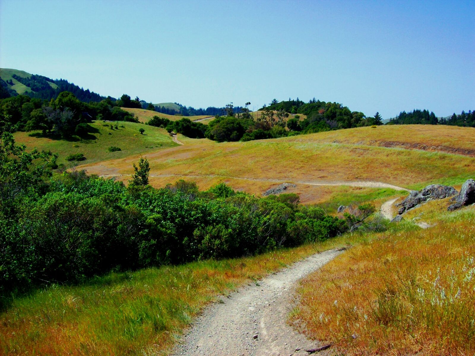
The 2019 Nav-X Challenge's 6th event brings us to Camp Tamarancho in the hills West of Fairfax, CA. This interesting area has a nice variety of terrain, from redwood forests and deep canyons to open grassland. Bill and Heidi Cusworth are designing 2- or 4-hour adventures using an excellent Bay Area Orienteering Club map. It promises to be an event not to be missed, regardless of whether you're looking for a beautiful hike or an endurance race against some of the best in the West.
Schedule
| Time | Long Course - 4h | Short Course - 2h |
|---|---|---|
| 8:00 | Event Check-in (and Day of Event Registration) | |
| 9:00 | Event Check-in (and Day of Event Registration) | |
| 9:15 | Event Briefing | |
| 9:30 | Mass Start | First Timer Clinic - Map Help |
| 10:15 | Event Briefing | |
| 10:30 | Mass Start | |
| 12:30 | Finish | |
| 13:00 | 2h Awards | |
| 13:30 | Finish | |
| 14:00 | 4h Awards |
NEW TO MAP TREKKING OR ROGAINING?
Map Trekking is a “Navigation Sport” that has elements of a few other sports and activities like Trail Running, Fell Running (XC hill running), Hiking, Orienteering and Geo Caching. More specifically, Map Trekking is a time-based challenge, 2 hrs or more in length, where participants try to score as many points as possible within the time allowed, by visiting checkpoints scattered across a vast, wild landscape. Participants are free to decide which checkpoints to visit, and in what order. Typically, a set time is allowed before the start for participants to study the map, and determine their route. Participants travel on foot and navigate their chosen route using the map and a compass (No GPS allowed except for recording your track). A late finish comes with point penalties, adding another layer of challenge to the sport. Checkpoints vary in difficulty and the point value reflects the same, so that easy ones yield a lower point value than difficult ones. To encourage beginners, course setters typically provide plenty of easy checkpoints near the start and finish location.
VENUE / PARK INFO
The camp, located in the hills just west of Fairfax, offers a taste of just about every type of terrain the Bay Area has to offer. From gentle, rolling grass-covered hills, to canyons filled with towering Redwood trees, and everything in between! The camp area in the center of the map is relatively flat, and will serve as the event center. The area beyond the camp is more secluded and often hillier. Rock features are scarce, but can be good attack points. You can expect to navigate through all types of vegetation, from open fields to all shades of "Green" (thicker vegetation). The course may even take you by the remote site of a WWII aircraft that crashed on a hillside, supposedly carrying "top secret" material used in the atom bombs dropped on Hiroshima and Nagasaki. While most of the debris was carried off by military officials the night of the crash, and the remainder buried on site, one of the plane's engines washed down into a camp creek years ago, and is now on display near the ranger station.
ABOUT THE MAP
ISOM standard; 1:10,000 scale; 5m contours; Moderate poison oak
COURSES AND DIVISIONS
There will be two courses offered:
2 hr Map Trek
4 hr Map Trek
Participants can compete in the following divisions:
Junior (19 & Under, 1-5 person teams)
Open Female (20-49, 1-5 person teams, All-female)
Open Male (20-49, 1-5 person teams, All-male)
Open Mixed (20-49, 2-5 person teams, mixed Male-Female)
Masters Female (50 and up, 1-5 person teams, All-female)
Masters Male (50 and up, 1-5 person teams, All-male)
Masters Mixed (50 and up, 2-5 person teams, mixed Male-Female)
Family - Adults (20+) + children (12 & under)
Results from this event count toward the 2019 Series Championship.
Price
Early fees (20% off) through Nov 2nd (via online registration). Regular fee is Nov 3rd - Nov 13th (via online registration). Day of Event Registration is cash or check only.
Discounts for orienteering club members (BAOC/GCO/etc...), $3 for adults (no member discount for juniors). Discount applied during online registration process.
For family teams (2-hr course only), it is required to have at least one adult (20 & over) and at least one child (12 & under). Children 12 & under race free. Children must be registered and accompanied by an adult.
Additional fees to rent an e-punch ($5) and/or compass ($2). Only one e-punch number or rental request is required per team. On the registration page, please enter "0" for e-punch number if you are not the first person registering for your team. No e-punch trade-ins allowed (ie. to get a higher punch count e-punch).
| Early Registration | Regular Registration | Day of Event Registration | ||||
|---|---|---|---|---|---|---|
| Course Length | 2h | 4h | 2h | 4h | 2h | 4h |
| Junior (19 & Under) | $14 | $20 | $16 | $23 | $18 | $25 |
| Adult (20+) | $28 | $40 | $32 | $45 | $35 | $50 |
REFUND POLICY
Refund policy: 100% refund up to 10 days before event. Future race credit 1-9 days before event. No refunds for no-show.
WHAT TO BRING
Wear what you would normally wear for a strenuous hike in Northern California. Here are some tips:
Sturdy shoes with a good tread
Long pants or gaiters
Visor hat
Compass (you may rent one for $2)
ePunch (SI stick with 50 control capacity - you may rent one for $5 if you don’t have one)
Pen and maybe a highlighter marker (for marking up your map and making notes)
Water (enough for the time you will be out on the course)
On the go snacks (energy bar, gel, etc.)
MAP AND DIRECTIONS
From 101, take the Central San Rafael exit or the Sir Francis Drake exit and proceed to Fairfax. Whatever route you choose, you will end up on Sir Francis Drake Blvd; continue westbound on this road past downtown for another quarter mile, and look for the green highway sign that says "Camp Tamarancho". Turn left at this sign onto Olema Road, and continue to follow the subsequent green camp signs until you reach Iron Springs Road. Head up Iron Springs Road for two miles until it ends at the camp entrance. Continue on the camp road to parking.