
2016 NAV-X Challenge @ Deer Creek Hills
***Course/Event Notes as of Nov 2nd 2016***
Quick Info
Date: Sunday November 6, 2016
Location: Deer Creek Hills Preserve, Rancho Murieta, California
Event Director: Bill and Heidi Cusworth
Course Director: Heidi Cusworth
Courses: 2 hr and 4 hr Map Trek (aka Rogaine)
Produced in cooperation with Gold Country Orienteers (GCO)
$25-$41 - juniors 40% off, early registration 25% off
REGISTER NOW!
Event summary
The 5th event in the inaugural 2016 Nav-X Challenge Series brings us to the oak studded hills and prairie of Deer Creek Hills Preserve. This is a first! No navigation sports event has ever been held here before. The event will be held in the expansive and wild preserve just North of Rancho Murieta, 30 minutes East of Sacramento. Using a new 4,500 acre map created by Bill Cusworth (not yet Orienteering level detail, but perfect for Map Trekking), Heidi Cusworth is designing the courses for a total adventure of either 2 or 4 hours. This event is co-produced with Gold Country Orienteers (GCO).
Schedule
8:30 - 9:45 Event Check-in (and Late Registration)
8:45 Maps available
8:45 - 9:45 First Timer Assistance with Maps
9:45 Event briefing
10:00 Mass Start
11:30 - 2:30 Snacks and Refreshments
12:00 Noon Finish for 2 hr participants
12:30 2 hr Awards
2:00 Finish for 4 hr participants
2:30 4 hr Awards
New to Map Trekking?
Map Trekking is a “Navigation Sport” that has elements of a few other sports and activities like Trail Running, Fell Running (XC hill running), Hiking, Orienteering and Geo Caching. More specifically, Map Trekking is a time-based challenge, 2 hrs or more in length, where participants try to score as many points as possible within the time allowed, by visiting checkpoints scattered across a vast, wild landscape. Participants are free to decide which checkpoints to visit, and in what order. Typically, a set time is allowed before the start for participants to study the map, and determine their route. Participants travel on foot and navigate their chosen route using the map and a compass (No GPS allowed except for recording your track). A late finish comes with point penalties, adding another layer of challenge to the sport. Checkpoints vary in difficulty and the point value reflects the same, so that easy ones yield a lower point value than difficult ones. To encourage beginners, course setters typically provide plenty of easy checkpoints near the start and finish location.
Venue / Park Info
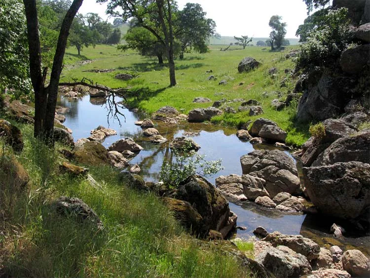
Deer Creek Hills' 4,500 acres of rolling grasslands and oak woodland preserves the heritage of working ranches and provides endless opportunities for public recreation. The oaks and grasslands also provide habitat for approximately 170 species of birds, 105 mammal species, 58 amphibians and reptiles, and an estimated 5,000 kinds of insects.
The town of Michigan Bar numbered about 15,000 people during the Gold Rush period. The town site (near the Deer Creek Hills Preserve) now hosts only a few stone chimneys. Evidence of small mining operations abounds on the preserve. Basque sheep ranchers ran their livestock here in the 1800’s.
The landscape around you is a typical, extremely scenic low foothill California landscape. The native blue oaks provide important cover for deer, coyotes, bobcats, burrowing owls, mountain lions between the valley and the mountains. Hawks, falcons, eagles, kites, owls, red-winged blackbirds, acorn and Lewis’ woodpeckers abound here.
The preserve is managed by the Sacramento Valley Conservancy.
About the Map
The map we will be using is a new (2016) map produced by the Gold Country Orienteers, enlisting the help of Bill Cusworth. The map does NOT include orienteering level detail, but is specifically created to support Map Trekking. Its scale is 1:15,000, meaning that 1 cm on the map is 150 m in the terrain. The contour interval (elevation between two contour lines) is 5 m (~16 ft) with 2.5 m "form lines" in flatter areas.
The terrain is similar to the open terrain at Pacheco, except it is much less steep. It is very runnable, and the ability to climb hills will not be the determining factor at this event. There are rock features all over, most of which will not be mapped for this event. Large rock features will be mapped, and used for control locations. It is quite open with typical coastal range oak studded hills. Creeks, ponds and vernal pools that may have water in the winter and spring will be dry at the time of the event (unless we have an early arrival of winter storms). We will provide water on the course.
Courses and Divisions
There will be two courses offered:
2 hr Map Trek - collect as many points as you can in 2 hours
4 hr Map Trek - collect as many points as you can in 4 hours
Participants can compete in the following divisions:
Junior Mixed/Male (Under 20, 1-5 person teams, All-male or mixed Male-Female)
Junior Female (Under 20, 1-5 person teams, All-female)
Open Mixed/Male (20-49, 1-5 person teams, All-male or mixed Male-Female)
Open Female (20-49, 1-5 person teams, All-female)
Masters Mixed/Male (50 and up, 1-5 person teams, All-male or mixed Male-Female)
Masters Female (50 and up, 1-5 person teams, All-female)
Results from this event count toward the Series Championship.
Fees
| By Oct 23 | By Nov 3 | At Event | ||||
|---|---|---|---|---|---|---|
| Course Length | 2h | 4h | 2h | 4h | 2h | 4h |
| Junior (under 20) | $15 | $25 | $17 | $27 | $19 | $31 |
| Adult (20+) | $25 | $41 | $28 | $45 | $31 | $51 |
OUSA/Club member discounts apply ($4 off adults, $2 off juniors)
Register here. See who has signed up here.
What to Bring
Wear what you would normally wear for a strenuous hike in May in Northern California. Here are some tips:
Sturdy shoes with a good tread
Long pants or gaiters
Visor hat
Compass (you may rent one for $1 + $5 refundable deposit if you don’t have one)
ePunch (SI stick with 60 control capacity - you may rent one for $5 if you don’t have one)
Pen and maybe a highlighter marker (for marking up your map and making notes)
Water (22 oz bottle, or a small camelbak)
On the go snacks (energy bar, gel, etc.)
Race for Less - Volunteer!
$10 cash back if you help us out getting the controls picked up after. Email Event Director if interested.
Parking
Parking is limited - carpool if you can. The access road to the parking area, event center, is a bit rough, but you do not need high clearance or 4WD vehicle. The road crosses a creek that may have water in it, however, the water depth is not deep enough to be of concern, except for severe downpours (if this happens, we will provide shuttle).
Map and Directions

From Sacramento – Take Hwy 50 to Bradshaw Exit, turn right (South) onto Bradshaw, turn left (East) onto Jackson Rd (Hwy 16), continue East, past Slough House, turn left (North) onto Latrobe Rd. Proceed about 1/2 mile east on the dirt portion of Latrobe Road, until you arrive at the corral parking area, where you will see our event flags.
From Folsom – Take Hwy 50 to Scott Rd. Exit, turn left (South) onto Scott Rd., turn right (West) onto White Rock Rd., turn left (South) onto Scott Rd., turn left (East) onto Latrobe Rd.
From Rancho Cordova – Take Jackson Rd (Hwy 16) east, turn left (North) onto Latrobe Rd. Proceed about 1/2 mile east on the dirt portion of Latrobe Road, until you arrive at the corral parking area, where you will see our event flags.
From Elk Grove – Take Grant Line Road to Jackson Rd (Hwy 16), turn left (North) onto Latrobe Rd. Proceed about 1/2 mile east on the dirt portion of Latrobe Road, until you arrive at the corral parking area, where you will see our event flags.
GPS: 38.5106364,-121.1115043